


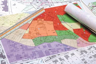
A brilliant presentation at the BCO annual conference last month highlighted the way property and technology are coming together in new ways that should lead to big increases in time and cost efficiency, with the potential to iron out disputes if there is a demonstrable correct answer.

The presentation was of a new digital model of London called Vucity. It has been developed by Wagstaffs Design, which specialises in digital media in various forms, working with Gordon Ingram Architecture, known to many as a rights-of-light consultant but that is now spreading its digital wings too.
Vucity is light years ahead of the old SimCity model, partly because so far it has focused on one city, London, but more importantly because of the sophistication of games technology, which it has used to extraordinary effect.
A huge swathe of the capital is now modelled in detail, to an accuracy level of a few centimetres, and the load time is very fast.
Using this model, which is already being adopted under licence by several London local authorities, users can do a huge variety of things at high speed. For example, we can get the equivalent of verified views of anything from anywhere; we can add in proposals that have planning consent; we can further add proposals in the public domain yet to be approved.
It will be easy to get accurate views from the perspective of the pedestrian
In other words, we can start to have a sensible discussion about views, particularly involving tall buildings, that are based on reality, not a couple of perspectives carefully chosen to illustrate either that the building has no effect whatsoever or that it is a monstrous blot on the landscape from all directions. That will not wash any more.
Not only can we view existing or proposed developments, but we can take a view from them too. Suppose someone wants to know what it would be like looking out from the 30th floor of the Cheesegrater - a couple of clicks will take them there. Another click will reveal buildings with planning permission and another will detail proposals in the planning pipeline. The results can be startling.
Real-time images
Routine exercises such as sun and shadow paths can be revealed in a couple of seconds and we can pick any month and any time if we want to be specific. It does not stop there. It is even possible to receive real-time street images from closed-circuit television cameras of the sort operated by Transport for London.
The intention is to make the system available under licence. The most likely users will be planning authorities, planning consultants, large firms of architects and of course some developers and agents. Will community groups be able to access the information without paying?
Probably not, but there will be nothing to stop any licensee sharing information if it is not-for-profit, which will raise concerns in the minds of those who regard pressure groups with fear and loathing.

On the other hand, the possibility of getting the full picture about any development is more likely, in my judgement, to undermine bogus objections on grounds of appearance or interference with views, because it will be possible as a matter of course to get the full visual story in a matter of seconds - we will no longer have to rely on the idea that only three or 12 views really matter because it is too expensive to generate more.
Most important, it will be easy to get accurate views from the perspective of the pedestrian. One of my favourite views in London is from Fleet Street, where on one side near El Vino people can only see the Cheesegrater and the Gherkin on the skyline, while a few metres down the street near the Cheshire Cheese they can only see St Paul’s dome.
With the Greater London Authority trying to enhance planning procedures by entering the digital world and with the Nick Leslau-backed Built-ID making waves by telling us everything about the built environment (sort of), things are on the move. Disruption can be invigorating.


No comments yet